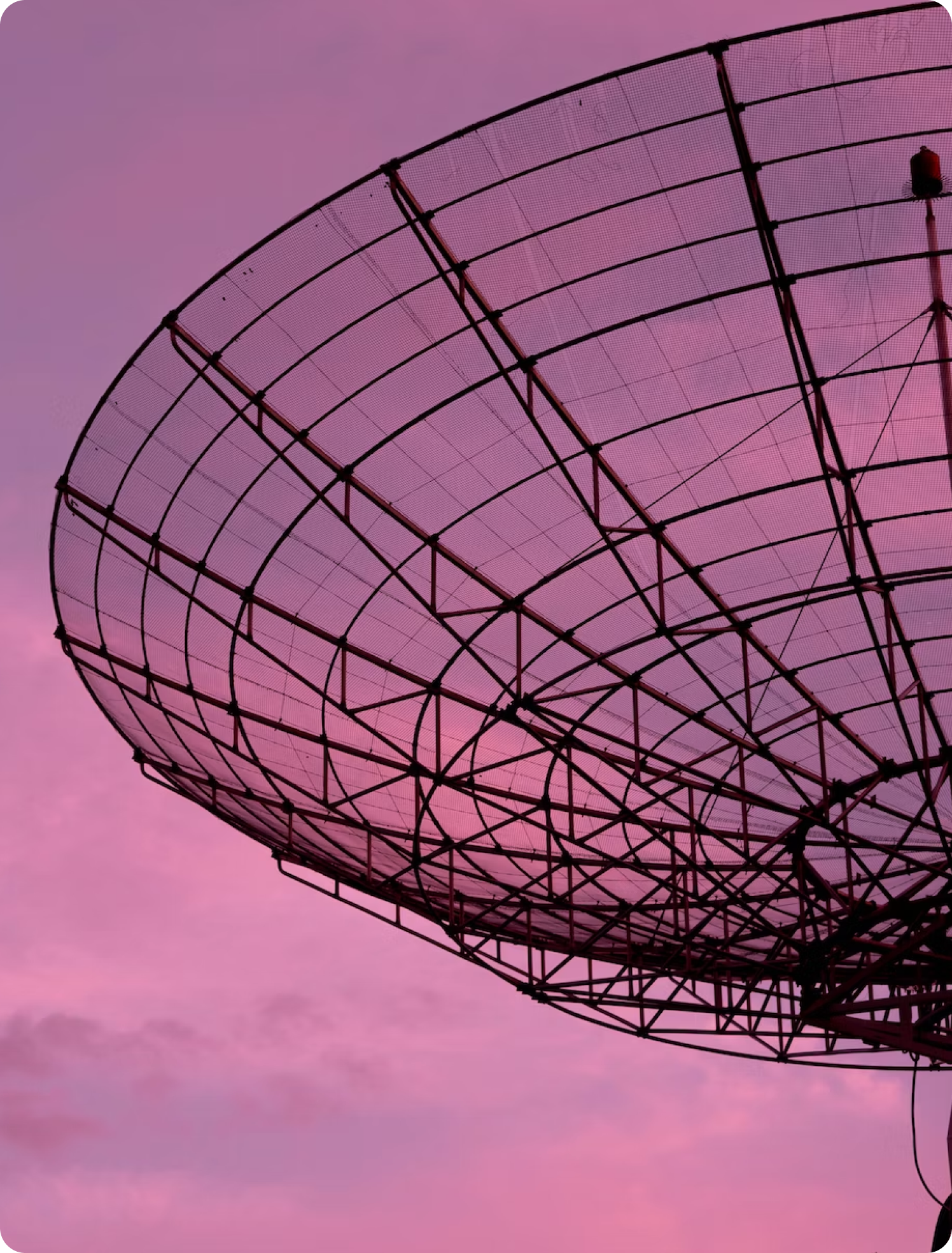
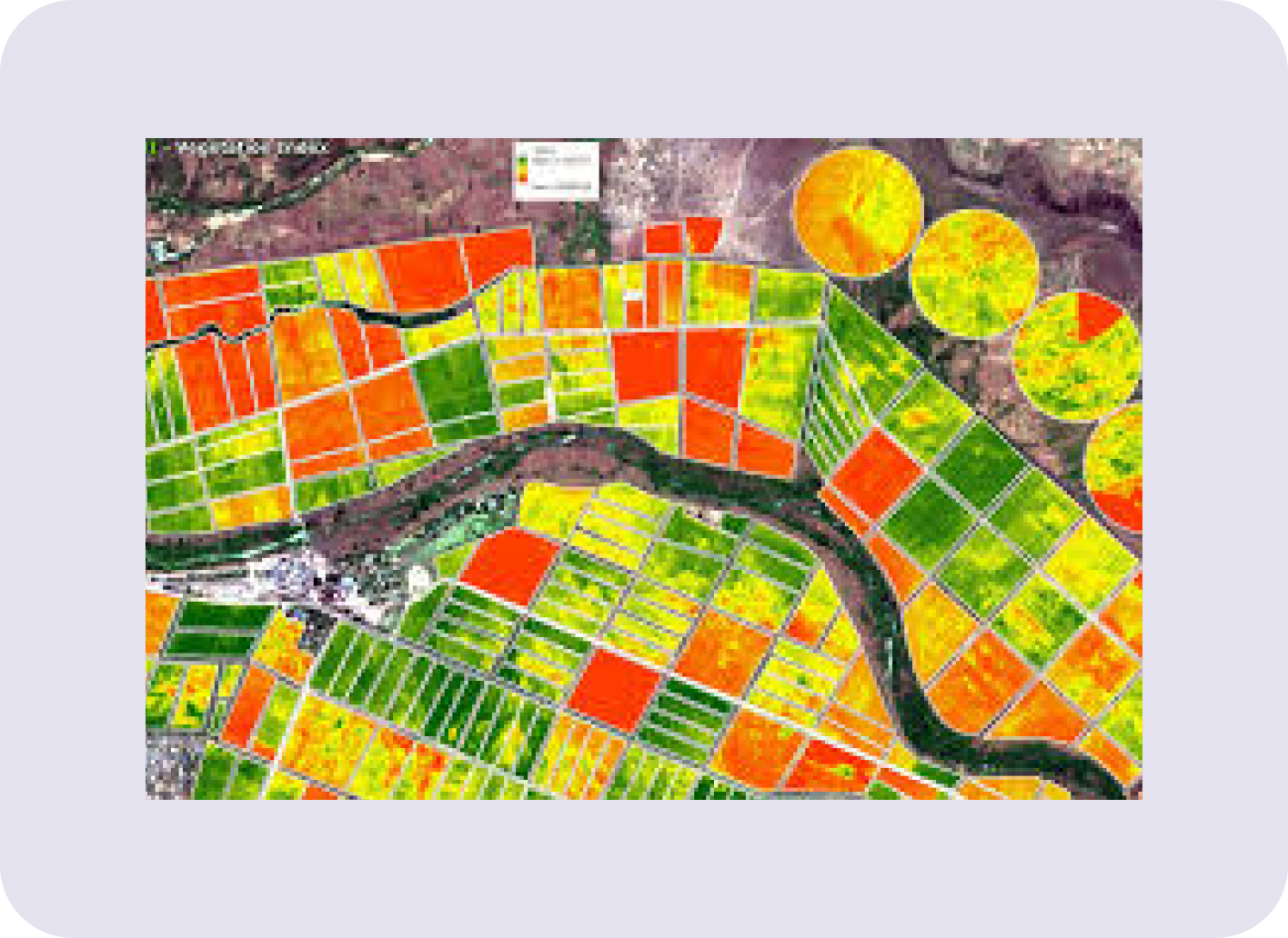
Satellite Imagery
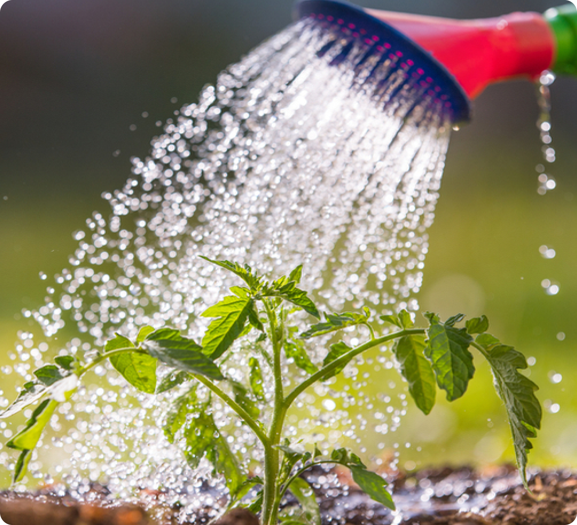
Welcome to CROP
Damage Assessment
The CROP damage assessment tool developed by Impetus AI Solution is an advanced technology designed to aid insurance companies in evaluating agricultural damage accurately and efficiently. By leveraging satellite imagery and artificial intelligence, the tool identifies and quantifies crop damage, streamlining the assessment process and providing actionable insights through a comprehensive reporting dashboard.
Features
Product Features
The software seamlessly integrates shape input files from
insurance companies, ensuring a smooth workflow and easy data
transfer. This feature enhances efficiency by eliminating
compatibility issues and streamlining the integration process.
It includes a sophisticated record segmentation capability that
detects anomalies such as polygon overlaps and areas exceeding
specified thresholds. Users can review and categorize records,
facilitating efficient data management and quality control.
The software leverages satellite imagery from both pre- and
post-incident dates to provide a comprehensive assessment. This
integration enables precise analysis and visualization of
changes over time, enhancing accuracy in identifying and
analyzing incidents
It offers computation of standard vegetation indices like NDVI
(Normalized Difference Vegetation Index), SAVI (Soil-Adjusted
Vegetation Index), and EVI (Enhanced Vegetation Index) to
evaluate crop health. Additionally, users have the flexibility
to create and compute custom indices tailored to specific needs
or research requirements.
Advanced AI technology is employed for anomaly detection and
patch classification. This feature enables the software to
automatically identify irregularities and classify patches based
on predefined criteria, enhancing efficiency and accuracy in
data analysis.
The software quantifies farm losses by comparing pre- and
post-incident satellite imagery. This capability provides
valuable insights into the extent of damage or loss, supporting
timely and informed decision-making for stakeholders.
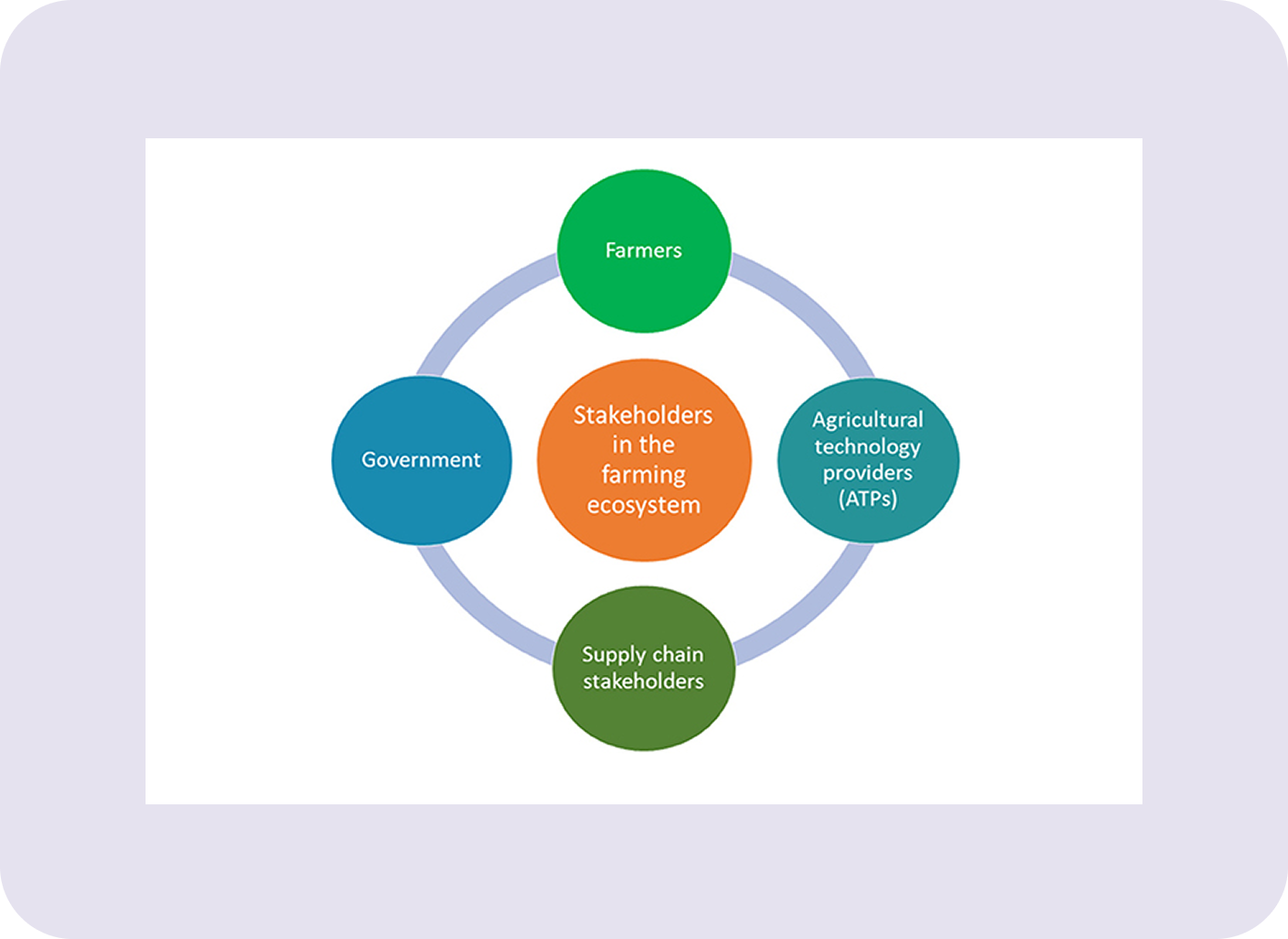
Why Choose CROP Damage Assessment?
iSportzAI Solutions is designed to meet the evolving needs of the sports industry. By integrating advanced technology with user-friendly features, we offer a platform that is both powerful and accessible. Whether you are a player seeking to improve your skills, a coach aiming to provide the best training, or a stadium manager looking to optimize operations, iSportzAI Solutions has the tools you need to succeed.

Our Benefits
Benefits
Innovation
-
▪
Incorporates cutting-edge AI and satellite technology to revolutionize crop damage assessment.
-
▪
Provides advanced features like custom index computation and AI-driven patch classification.

Efficiency
-
▪
Incorporates cutting-edge AI and satellite technology to revolutionize crop damage assessment.
-
▪
Provides advanced features like custom index computation and AI-driven patch classification.

Revenue
-
▪
Incorporates cutting-edge AI and satellite technology to revolutionize crop damage assessment.
-
▪
Provides advanced features like custom index computation and AI-driven patch classification.

Data
-
▪
Incorporates cutting-edge AI and satellite technology to revolutionize crop damage assessment.
-
▪
Provides advanced features like custom index computation and AI-driven patch classification.
Purchase Plan
Purchase an annual subscription and
get extra tools for
FREE

Featured Answers Questions
FAQ's
The crop damage detection tool improves claim accuracy and speed by
using satellite imagery, AI, and remote sensing to monitor crop
health in real time. It enables precise identification of damaged
areas, reducing human error and ensuring objective assessments.
Automated analysis speeds up claim validation, allowing faster
payouts to farmers. The tool also minimizes fraud by providing
geotagged, verifiable evidence. Overall, it streamlines the
insurance process with accurate, data-driven decisions.
By merging meteorological information with satellite imagery, the
SWITCH model effectively identifies and assesses hail damage. This
novel technique delivers detailed, high-resolution evaluations that
are time-stamped, helping insurance companies to enhance their
claims processing efficiency.
Use Case Example:
After a cyclone, a drone equipped with multispectral imaging flies
over a sugarcane farm. Within 2 hours, it maps flood-affected zones,
highlights crop stress levels, and sends a report to the insurance
agent. This allows for fast, data-backed claim processing.
Drone-based mapping enhances crop damage evaluation in difficult
conditions by improving accessibility, accuracy, speed, and data
quality, all while reducing human risk and subjectivity.
Use case Example:
A flood affects a rice farm. Using drone imagery and AI, the tool
calculates that 3.7 hectares out of 10 are damaged, with 60% being
moderately affected. This prevents the farmer from claiming damage
to all 10 hectares and ensures fair compensation.
Aerial data tools help avoid overestimation by eliminating guesswork
and exaggeration, and they prevent underestimation by capturing
hidden or early-stage damage. This results in fairer, faster, and
more accurate crop insurance assessments.
Use case Example:
After a cyclone, satellite imagery detects damage patterns across
thousands of acres of maize. AI classifies the zones into “total
loss” and “recoverable.” Within 48 hours, local authorities initiate
aid and insurers begin claim processing. Accurate, up-to-date remote
sensing data helps insurers validate claims quickly and fairly,
ensuring timely compensation and reducing disputes.
Remote sensing is essential for timely crop damage management
because it offers:
Fast, large-scale monitoring
Early warning capabilities
Accurate, unbiased data
Actionable insights for quicker recovery and compensation
Use Case Example:
An AI model trained on rice crop health recognizes leaf
discoloration patterns that indicate fungal infection. It alerts the
farmer before symptoms spread, allowing targeted fungicide
application. This reliable early detection prevents a 30% yield
loss.
AI improves the reliability of crop damage detection by making it:
Objective (free from human bias)
Accurate (based on data, not guesswork)
Scalable (across large areas)
Timely (real-time insights)
Actionable (quantified reports for fast decisions)
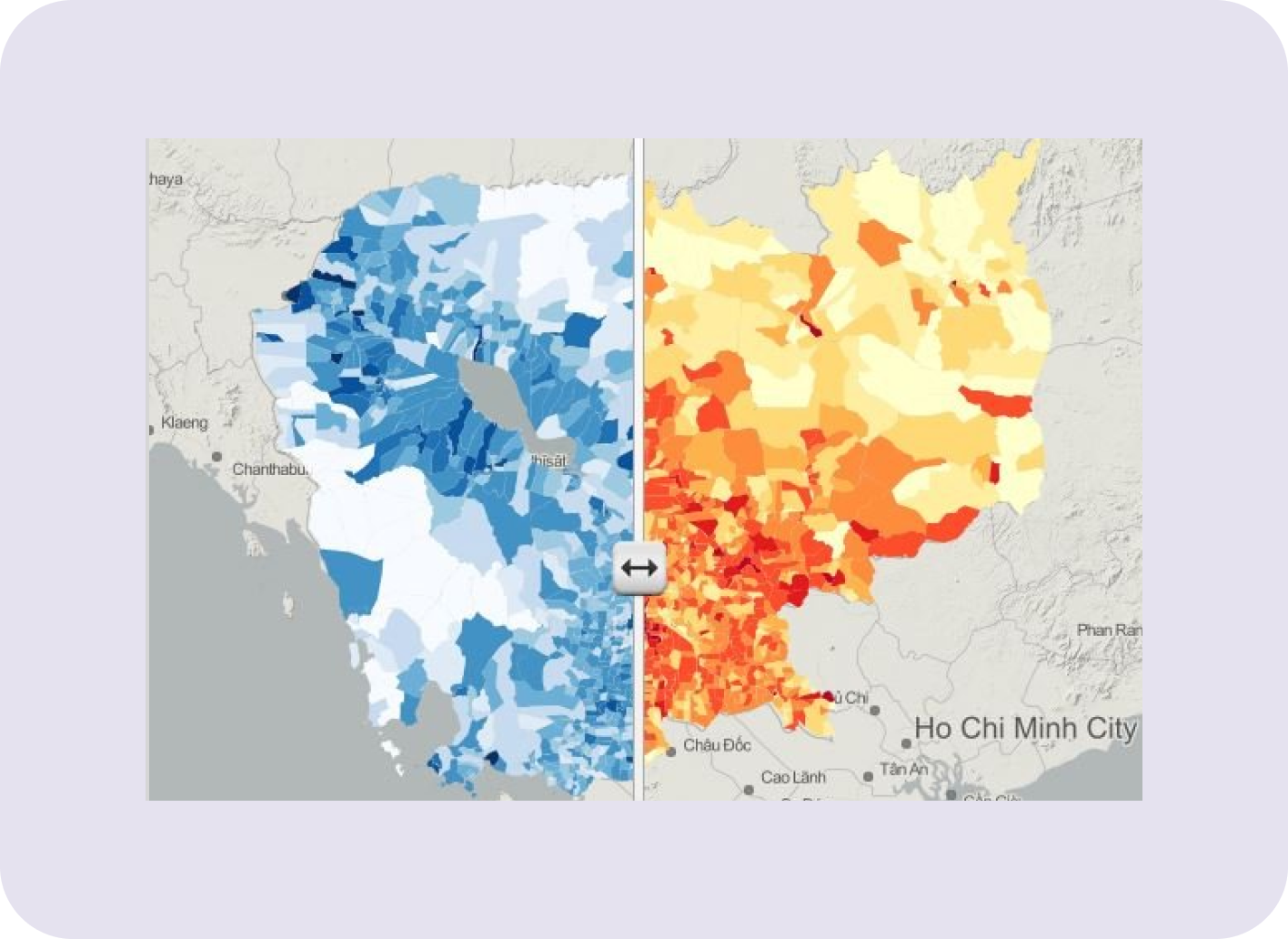
Use case Example:
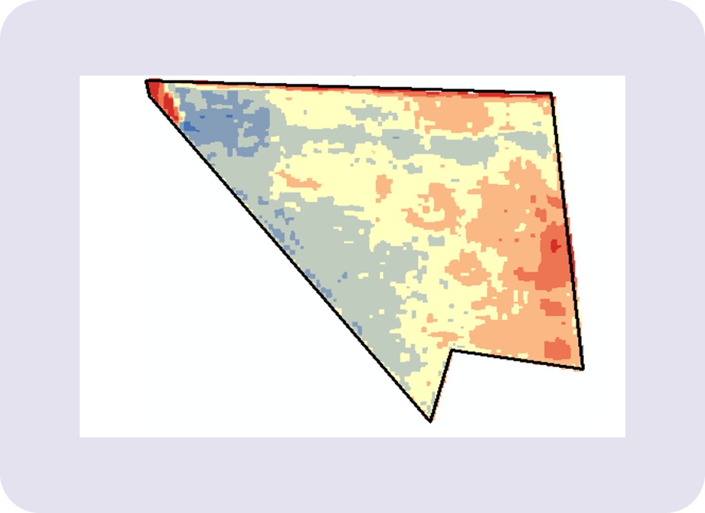
After a major cyclone in eastern India, satellite imagery was used
to assess crop damage across 10 districts within 48 hours. NDVI
analysis helped classify zones of total loss vs. partial damage,
enabling the government to quickly release targeted compensation.
Satellite imagery enables large-scale, timely, and data-driven
damage assessments by offering:
High-resolution and wide-area coverage
Historical comparisons
Objective, quantifiable insights
Support for scalable decisions in insurance and relief. It’s an
essential tool for modern agriculture, disaster management, and
agri-insurance at scale.
Early crop damage detection reduces financial losses by
Limiting crop loss through early action
Lowering input and treatment costs
Preserving yield quantity and quality
Supporting stronger insurance claims
Aiding smarter harvest and resource planning
It’s one of the most powerful tools for risk reduction and financial
resilience in modern agriculture
Crop Type: Cereal (Wheat, Rice).
Key Benefit from Remote Sensing: Large-area yield prediction,
disease/stress monitoring,
Crop Type: Oilseeds.
Key Benefit from Remote Sensing: Nutrient/water stress alerts,
flowering monitoring,
Crop Type: Root/Tubers.
Key Benefit from Remote Sensing: Subsurface stress detection,
optimal harvest timing,
Crop Type: Orchards/Vineyards.
Key Benefit from Remote Sensing: Ripeness tracking, pest/disease
management,
Crop Type: Vegetables.
Key Benefit from Remote Sensing: Rapid response to pest/disease,
yield estimation,
Crop Type: Plantation Crops,
Key Benefit from Remote Sensing: Long-term health tracking, water
use optimization
Real-World NDVI Monitoring for crops Application Example:
A rice farmer notices uneven growth. NDVI drone scans show a low
index in a specific corner. Upon inspection, it’s found that a water
pump was malfunctioning. NDVI detected stress before symptoms became
visible. This saved 20% of potential yield loss.
NDVI Monitoring for crops and Benefits in Agriculture
Quantifies plant health
Early warning of stress/damage
Covers large areas consistently
Supports data-driven decisions
Enables faster insurance claim validation
Traditional crop damage survey methods typically involving manual
field inspections and farmer self-reporting have several limitations
that affect their accuracy, speed, cost-efficiency, and scalability.
Aspect : Speed, Accuracy, Coverage,Cost,Consistency,Evidence
Quality,Insight Depth.
Limitations:
Too slow for timely action,
Prone to human error and bias,
Is Inadequate for large or remote areas,
Labor- and cost-intensive,
Varies between surveyors and locations,
Lacks reliable, objective data,
Cannot detect early-stage or subsurface issues.
Mobile applications enable farmers to report crop damage instantly
by streamlining the process, enhancing accuracy, and linking them
directly to support systems. They minimize delays, increase
transparency, and facilitate data-driven decision-making on a large
scale rendering them a vital resource in contemporary agricultural
risk management.Key Benefits of Mobile Crop Damage Reporting Apps
Feature : Real-time reporting,Geo-tagging & timestamping, Smart
guidance, Integration with imagery,Notifications, Offline
capability, Multi-language support.
Benefit :Speeds up assessment and relief, Adds credibility to
claims,Reduces reporting errors, Improves accuracy and
validation,Keeps farmers informed,Enables use in remote
areas,Ensures accessibility for all farmers
Machine learning enables smart, scalable, and timely classification
of crop damage by analyzing patterns in large datasets. It improves
the reliability of assessments, speeds up response, and ensures fair
compensation making it a cornerstone of modern precision agriculture
and agri-insurance systems
Types of Crop Damage ML Can Classify:
Flood damage
Drought stress
Nutrient deficiencies
Pest and insect attacks
Fungal or bacterial diseases
Wind/hailstorm-induced physical damage
Drone-based crop monitoring uses a combination of sensors
RGB cameras for general observation
Multispectral sensors for early plant stress detection
Thermal sensors for water stress and disease
LiDAR for elevation and structural mapping
Hyperspectral sensors for advanced diagnostics
Real-time data is critical in crop loss evaluation after natural
disasters because it enables immediate, accurate, and data-driven
decision-making during a time when every hour counts
Real-time data enables:
Instant mapping of affected areas. Faster validation of claims.
Quick disbursement of government relief or insurance payments
Initial damage vs. recoverable zones
Areas needing immediate attention (irrigation, pest control, etc.).
Disputes between farmers and insurers. Chances of over-reporting or
fraudulent claims
echnology tools like drones, satellites, sensors, and AI can detect
a wide range of crop damage causes by analyzing changes in plant
health, temperature, structure, and environment. Here are the main
causes of crop damage that these tools can accurately identify
Damage Cause of : Flooding/Waterlogging and Detection Tools: NDVI,
SAR, drone imagery ,
Damage Cause of : Drought/Water Stress and Detection Tools: Thermal
sensors, NDVI, soil moisture tools ,
Damage Cause of : Pests/Diseases and Detection Tools: Multispectral,
AI, hyperspectral sensors ,
Damage Cause of : Nutrient Deficiency and Detection Tools:
Chlorophyll index, red-edge sensors ,
Damage Cause of : Hail/Frost/Storms and Detection Tools: RGB + LiDAR
imagery, canopy monitoring,
Damage Cause of : Soil Issues and Detection Tools: LiDAR, soil
sensors, multispectral cameras ,
Damage Cause of : Fire and Detection Tools: Thermal imaging, drone
mapping ,
Damage Cause of : Animal Damage and Detection Tools: Drones, motion
sensors, field cameras.
GPS tagging plays a crucial role in improving the transparency,
accuracy, and accountability of field assessments in agriculture,
especially in crop damage evaluation and insurance claims.
Integrating weather data into crop damage prediction models
significantly enhances their accuracy, timeliness, and usefulness.
Weather is a major factor influencing crop health, and combining it
with AI and remote sensing enables predictive insights that
traditional methods can’t match
Blockchain can revolutionize crop insurance by making claims secure,
transparent, and tamper-proof. In a system where trust, data
integrity, and timely payouts are critical, blockchain ensures every
step of the claim process is verifiable, auditable, and automated
Crop damage assessment tools, such as drones, remote sensing, mobile
apps, and AI analytics, can significantly enhance the effectiveness
of government insurance schemes like PMFBY (Pradhan Mantri Fasal
Bima Yojana). These technologies help address long-standing issues
such as delayed claims, inaccurate assessments, and a lack of
transparency.
Pricing And Plan
1 monthly fee for all IT services.
Let’s Discuss Your
Product Roadmap
Book an architecture assessment call with our senior tech experts to map features and receive execution pathways.